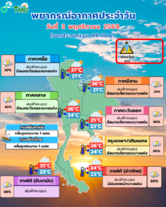


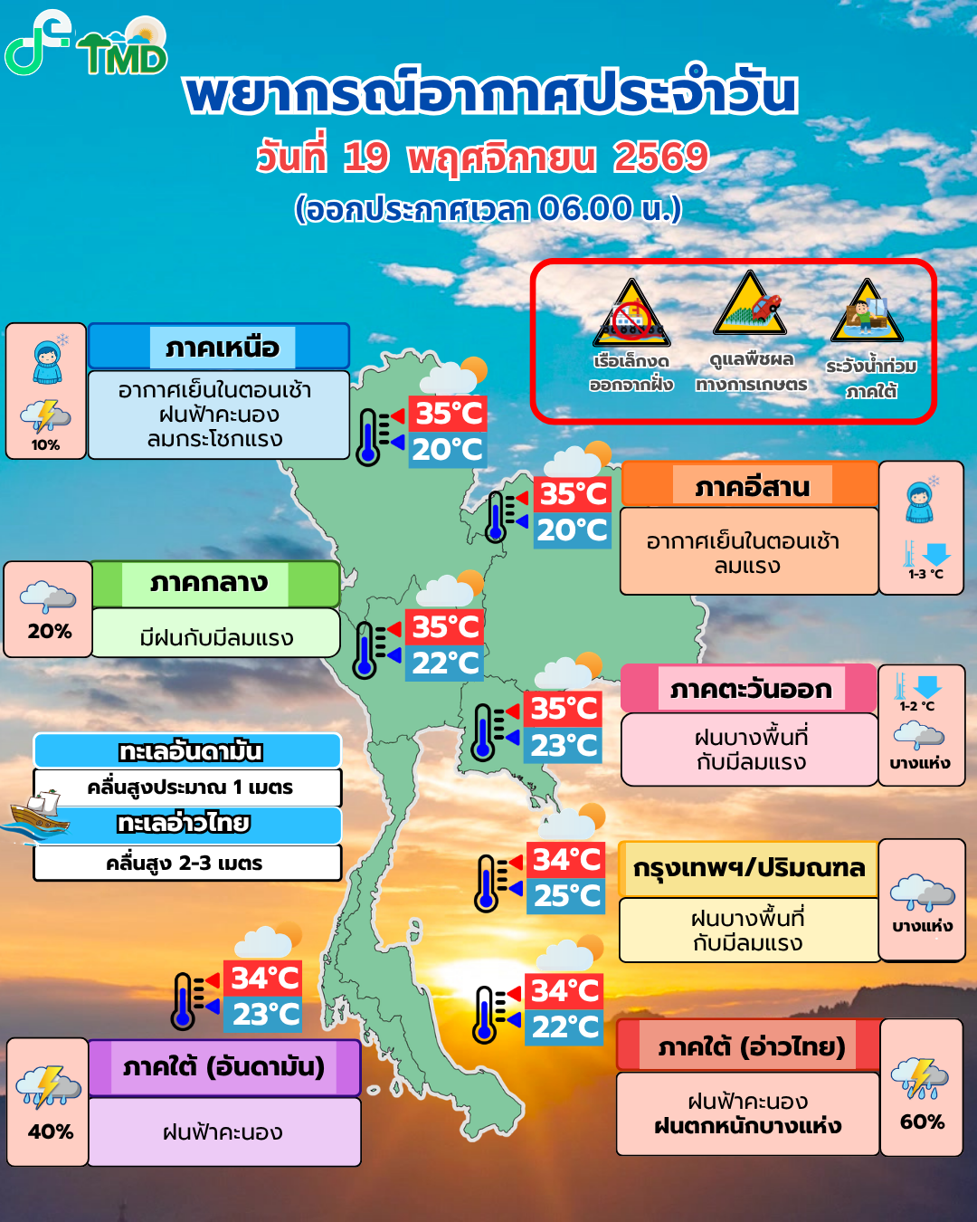
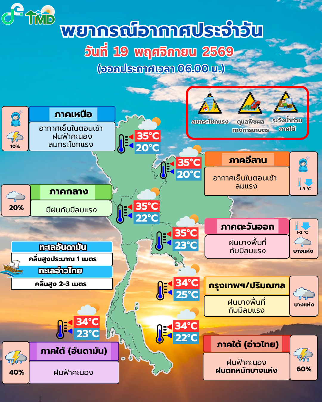
กรมอุตุนิยมวิทยาออกพยากรณ์เวลา 11.00 น. วันที่ 19 พฤศจิกายน 2569 ระบุว่าภาคใต้มีฝนหนักถึงหนักมากบางแห่ง และอ่าวไทยตอนล่างมีคลื่นสูง 2–3 เมตร ขณะที่ภาคอีสานจะเย็นลง 2–3 องศาเซลเซียส ประกาศเตือนฉบับที่ 9 ครอบคลุมผลกระทบช่วง 19–22 พฤศจิกายน ขอให้ประชาชนพื้นที่เสี่ยงและชาวเรือติดตามข้อมูลล่าสุดก่อนเดินทาง
รายงานภาคใต้ฝั่งตะวันออกระบุฝนหนักในสุราษฎร์ธานี ปัตตานี ยะลา และนราธิวาส โดยมีฝนหนักมากบางพื้นที่ของนครศรีธรรมราช พัทลุง และสงขลา ส่วนฝั่งตะวันตกมีฝนหนักบางแห่งในกระบี่ ตรัง และสตูล ข้อมูลนี้เป็นการพยากรณ์รายพื้นที่ ไม่ใช่รายงานว่าทุกจังหวัดกำลังเกิดน้ำท่วม
คลื่นสูงและฝนสะสม: สิ่งที่ต้องระวัง
ตั้งแต่นครศรีธรรมราชลงไป กรมอุตุฯ คาดคลื่นอ่าวไทย 2–3 เมตร และสูงกว่า 3 เมตรในบริเวณฝนฟ้าคะนอง เรือเล็กในอ่าวไทยตอนล่างควรงดออกจากฝั่งจนถึง 22 พฤศจิกายน ส่วนประชาชนในพื้นที่ลาดเชิงเขา ใกล้ทางน้ำ และพื้นที่ลุ่ม ควรระวังน้ำท่วมฉับพลันและน้ำป่าไหลหลากจากฝนสะสม
เหนือและอีสานเย็นลง กรุงเทพฯ ลด 1–2 องศา
มวลอากาศเย็นจากจีนปกคลุมตอนบนของไทย อีสานมีแนวโน้มอุณหภูมิลดลง 2–3 องศาเซลเซียส ส่วนภาคเหนือ กลาง ตะวันออก รวมถึงกรุงเทพฯ และปริมณฑลลดลง 1–2 องศาเซลเซียส ภาคเหนือตอนบนยังมีฝนฟ้าคะนองบางพื้นที่ กรมอุตุฯ แนะนำให้ดูแลสุขภาพ และให้เกษตรกรภาคเหนือตอนบนป้องกันความเสียหายต่อผลผลิต
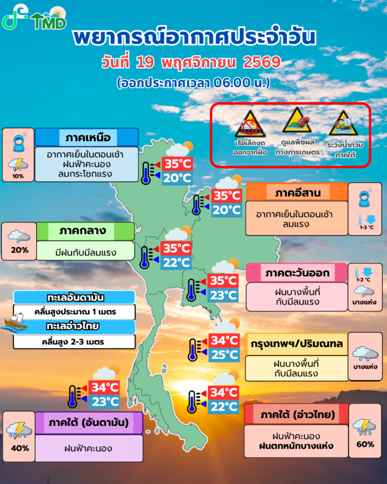
พยากรณ์รอบ 05.00 น. เป็นข้อมูลก่อนหน้ารอบเที่ยง ซึ่งแสดงแนวโน้มฝนใต้และอากาศเย็นลงเช่นกัน แต่รายละเอียดรายจังหวัดและอุณหภูมิอาจต่างกัน ผู้อ่านควรยึดประกาศฉบับล่าสุดเมื่อวางแผนเดินทาง
ตรวจประกาศล่าสุดก่อนออกเดินทาง
ฝนและคลื่นอาจเปลี่ยนตามเวลา โดยเฉพาะพื้นที่ชายฝั่งและพื้นที่น้ำไหลผ่าน กรมอุตุฯ ให้ติดตามประกาศต่อเนื่องที่เว็บไซต์หน่วยงานหรือสายด่วน 1182 ข่าวนี้อ้างอิงพยากรณ์ประจำวันที่ 19 พฤศจิกายน ไม่ใช่ภาพเหตุการณ์น้ำท่วมหรือสภาพทะเลแบบสด
Thailand Weather: Heavy Southern Rain and Rough Gulf Seas Forecast for November 19–22
The Thai Meteorological Department’s 11 a.m. forecast on November 19, 2026, calls for isolated heavy to very heavy rain in the South and waves of 2–3 meters in the lower Gulf of Thailand. The Northeast is expected to cool by 2–3°C. Its ninth warning covers the November 19–22 impact period and urges residents and mariners to follow updates.
On the southern east coast, heavy rain is forecast in Surat Thani, Pattani, Yala and Narathiwat, with very heavy rain in parts of Nakhon Si Thammarat, Phatthalung and Songkhla. Krabi, Trang and Satun may see heavy rain on the west coast. A forecast is not a report that flooding has occurred in all of these provinces.
Rainfall and sea conditions
From Nakhon Si Thammarat southward, Gulf waves are forecast at 2–3 meters, exceeding 3 meters in thunderstorms. Small boats in the lower Gulf should remain ashore through November 22. People in low-lying areas and near waterways or foothills should watch for flash flooding and runoff after sustained rain.
Cooling across upper Thailand
A high-pressure system from China is bringing wind and cooler conditions. The department expects a 2–3°C drop in the Northeast and a 1–2°C drop in the North, Central and East, including Bangkok and nearby provinces. Some thunderstorms remain possible in the upper North. Residents should plan for changing conditions, and farmers should protect vulnerable crops.
The 5 a.m. graphic above is an earlier forecast shown for comparison. For travel or marine decisions, consult the latest bulletin and the department’s 1182 hotline. These graphics depict forecasts, not live flooding or sea observations.
แหล่งข่าวและเครดิตภาพ / Sources and Image Credits
- กรมอุตุนิยมวิทยา พยากรณ์ 11.00 น. 19 พ.ย. 2569
- พยากรณ์ 05.00 น. 19 พ.ย. 2569
- ประกาศเตือนฝนใต้ ฉบับที่ 9
- ภาพประจำเรื่องและภาพแทรก 1: กรมอุตุนิยมวิทยา ภาพต้นทาง 11.00 น.; ภาพแทรก 2: กรมอุตุนิยมวิทยา ภาพต้นทาง 05.00 น.
#พยากรณ์อากาศ #ฝนใต้ #คลื่นลมแรง #กรมอุตุนิยมวิทยา #MiKONews